
September 2026 | The Skinner Team | Anne Skinner, Luxury Mountain Real Estate Expert
TL;DR
Peak color is expected earlier than usual this year, likely mid to late September across Summit and Eagle County. These five drives, from Boreas Pass to the Minturn-Red Cliff corridor, cover the best color in both counties without a long hike.
Here’s how to time it and where to point the car.
Anyone who has spent a September in Summit County or Eagle County knows the aspens do not wait for a weekend that works for everyone. The color can arrive, peak, and strip bare in under three weeks, and this year it is expected to turn several days earlier than usual after a hot, dry summer. If you own property in this corridor, or you are weighing whether to, a fall foliage drive is one of the best ways to experience it the way locals do: at twenty five miles an hour, windows down, watching gold roll up a hillside that was still green the week before.
Forecasters are tracking peak color across Aspen, Vail, Summit County, and the rest of the central mountains for roughly September 16 through 28 this year, and that window is running earlier than typical because a hot, dry summer has left many aspens stressed. Elevation drives the exact timing more than the calendar does. The highest passes in Summit County, places like Boreas Pass and Hoosier Pass above 11,000 feet, tend to turn first, sometimes in the second week of September. Lower elevations in the Eagle County valley near Vail hold their color a little longer, often into the final week of September. Weekday mornings are the easiest time to drive any of these routes. Trailhead parking fills fast on fall weekends, but the roads themselves stay clear, and morning light is more flattering on the aspens than the flat light of midday.
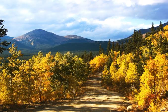
Boreas Pass Road begins at the south end of Main Street in Breckenridge and climbs a well maintained dirt road toward the Continental Divide. The lower stretch is passable in most passenger cars in dry conditions, and the drive rewards you with wide views back over the Blue River valley and the Tenmile Range as you gain elevation. Hoosier Pass, just south of town, is a different kind of drive entirely: fully paved, connecting Breckenridge to the small town of Alma, with sweeping views of changing aspens against the peaks on either side of the highway. Both drives are short enough to fit into a morning and still leave the rest of the day open, which makes them the easiest starting point if you are new to leaf peeping in Summit County.
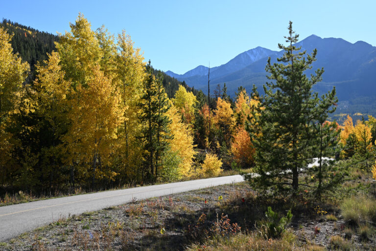
If you only have time for one drive this season, make it the Top of the Rockies National Scenic Byway. The route starts near Copper Mountain, climbs over Fremont Pass, and drops into Leadville, with an extension that loops back through Tennessee Pass, Camp Hale, Red Cliff, and Minturn before returning to Interstate 70. Locals and Colorado tourism officials alike point to this stretch as one of the state’s best fall drives, with long runs of aspen groves and wide open views of Colorado’s highest peaks along the way. Driven start to finish with a few stops, the full loop takes most of a day, but the Copper Mountain to Leadville leg alone is a comfortable hour and a half round trip if your schedule is tighter.
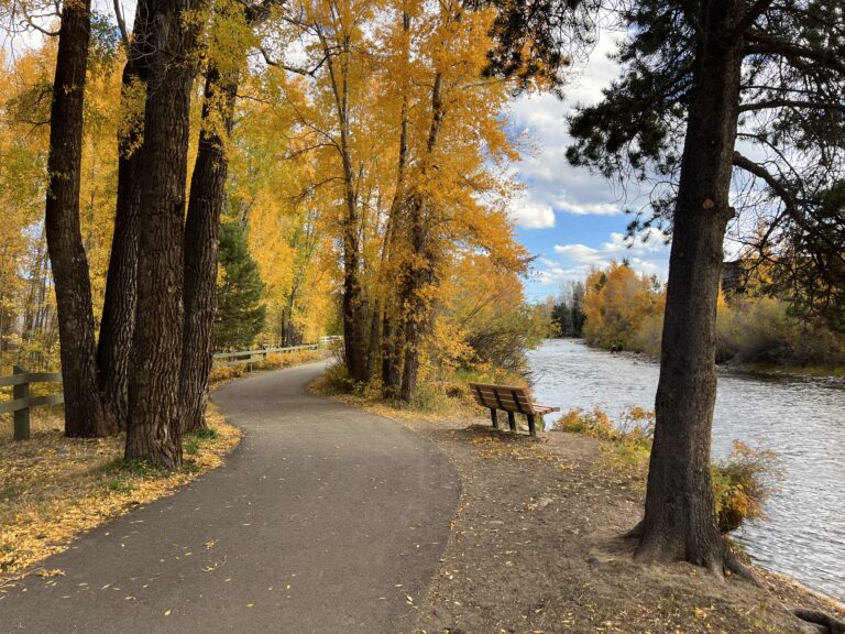
The southern half of the Top of the Rockies loop is where the drive earns its reputation. Climbing out of Minturn toward Red Cliff on Highway 24, the road winds up Battle Mountain through some of the most concentrated aspen color in either county. The Green Bridge Overlook, just before Red Cliff, is worth the pull off for a view of the Eagle River canyon and the arched bridge crossing it. From Red Cliff, the route continues past the Camp Hale-Continental Divide National Monument, a former World War II training ground for the Army’s 10th Mountain Division that now sits at the center of a protected valley ringed in gold each fall. For a shorter loop back toward Vail, Shrine Pass Road offers a well graded gravel alternative that avoids backtracking the same stretch of highway twice.
→ Not sure if your Vail or Beaver Creek property is priced for what the market is doing right now? Start with a free home valuation.
Timing a drive around Breckenridge Oktoberfest, running September 25 through 27 this year, is an easy way to pair a morning on Boreas Pass or Hoosier Pass with an afternoon on Main Street. If you are staying in Keystone, Dillon, or Silverthorne, all three sit within a short drive of the Summit County routes and make a convenient home base for a weekend built around color. Owners near Beaver Creek are closest to the Minturn and Red Cliff side of the loop and can reach Camp Hale in well under an hour. Whichever route you choose, dress in layers. Temperatures at these elevations swing more than twenty degrees between a cold morning start and an afternoon at lower elevation, and a dirt road that was dry on your way up can change quickly if weather moves in.
→ Curious what a second home near one of these routes could look like for your family? Get in touch with The Skinner Team.
→ Did you love the drive? You don’t have to go home. See what’s available in Summit and Eagle County right now.
Peak color across Summit County, Eagle County, and the rest of the central mountains is expected between roughly September 16 and 28 this year, running earlier than a typical season because of a hot, dry summer. Higher elevations, including Boreas Pass and Hoosier Pass, tend to peak first, while lower elevations near Vail often hold color into the final week of September.
Boreas Pass Road, starting at the south end of Main Street in Breckenridge, is the most accessible fall foliage drive in the area, with a well maintained dirt road that climbs into wide views of the Blue River valley. Hoosier Pass, a fully paved route to Alma just south of town, is a strong alternative if you would rather stay on pavement.
Yes. The full loop from Copper Mountain through Leadville, Tennessee Pass, Camp Hale, Red Cliff, and Minturn back to Interstate 70 takes most of a day with stops, but the Copper Mountain to Leadville segment alone is a comfortable hour and a half round trip if you are short on time.
The lower portion of Boreas Pass Road is passable for most passenger vehicles in dry conditions. Sections closer to the summit are unpaved and can be affected by weather, so it is worth checking current conditions before heading past Baker’s Tank.
The Minturn to Red Cliff stretch of Highway 24, which connects into the Top of the Rockies Byway, is the strongest option for a drive that bridges both counties. It passes the Green Bridge Overlook and the Camp Hale-Continental Divide National Monument before continuing on toward Leadville and Summit County.
Fall in Summit County and Eagle County has a way of making the case for mountain ownership better than any listing photo can. If a drive through Boreas Pass or the Top of the Rockies has you thinking about what it would mean to own here, The Skinner Team can help you understand what your property, or your next one, is worth in this market.




Disclaimer: All information contained in this web site is deemed reliable but not guaranteed. All properties are subject to prior sale, change or withdrawal notice. COMtnRealty.com believes all information to be correct but assumes no legal responsibility for accuracy.


